Enhancing Geospatial Data Workflows with Advanced Integration of PostgreSQL, GeoServer, and QGIS: A Case Study with the City of Tampere
A comprehensive case study demonstrating advanced integration of PostgreSQL, GeoServer, and QGIS for environmental data management in municipal workflows.

Empowering European Commission with GIS Capabilities Through QGIS Training
Strategic QGIS training program for European Commission officials, building institutional GIS capabilities at the highest levels of European governance.
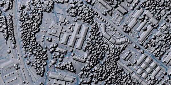
How to Handle Point Clouds in QGIS 3.18
Guide to working with point cloud data in QGIS 3.18, covering new features and workflows for LiDAR data processing.
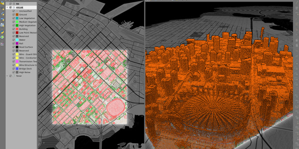
Driving Insights from Point Cloud Data with WhiteboxTools and QGIS
Tutorial on using WhiteboxTools with QGIS for point cloud data analysis and deriving actionable insights from LiDAR datasets.
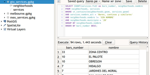
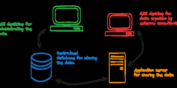
Learn Spatial SQL and Master GeoPackage with QGIS 3
Educational guide to learning spatial SQL through GeoPackage and QGIS, covering database concepts and practical spatial queries.
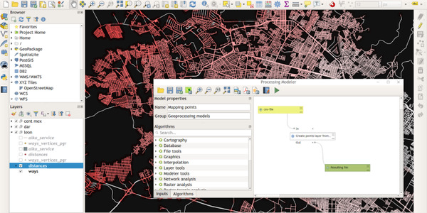
Automating GIS Processes with Graphical Modeler in QGIS
Tutorial on using QGIS Graphical Modeler for automating repetitive GIS processes and creating reusable analysis workflows.