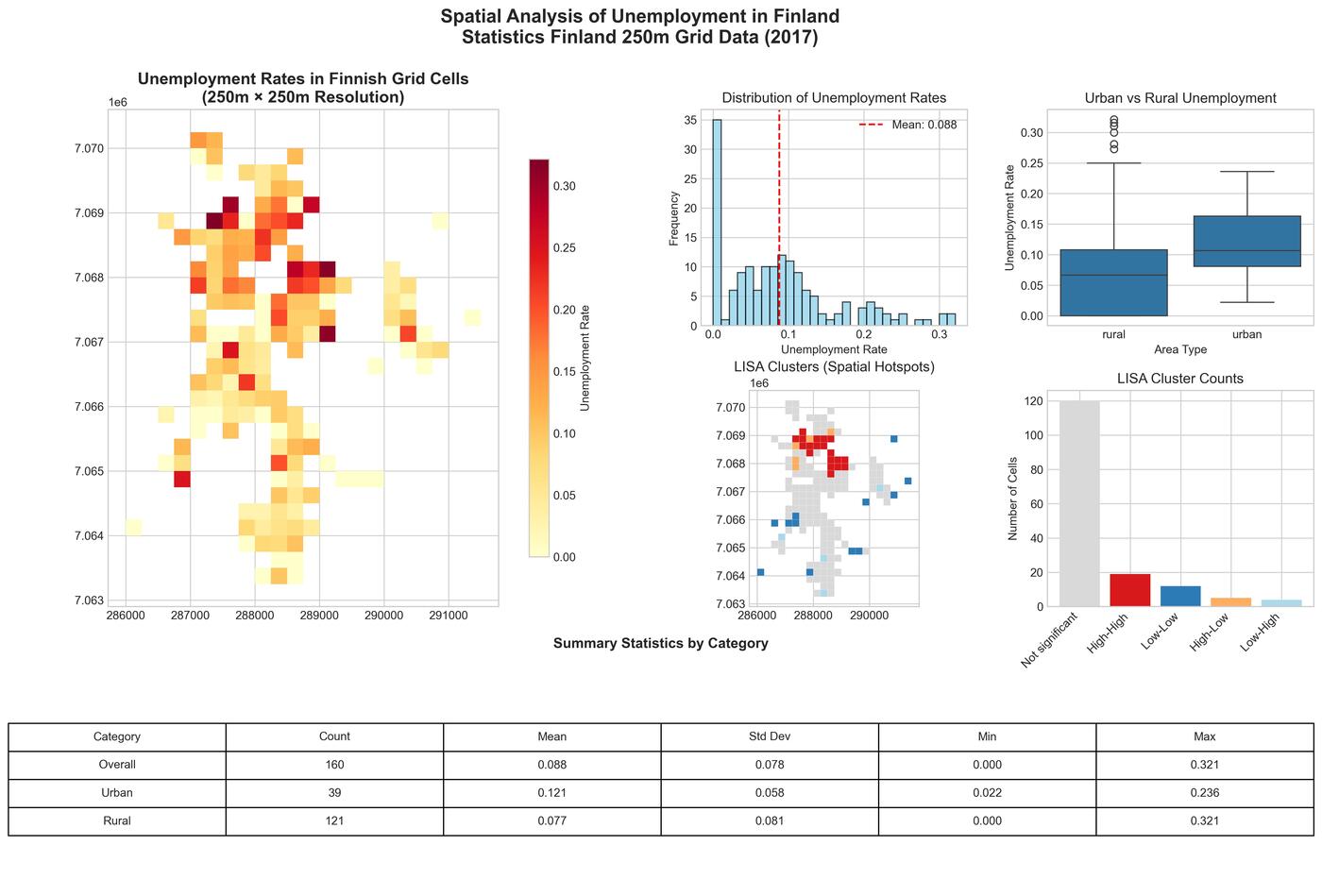
Mapping Unemployment: Spatial Patterns and Clusters in Jakobstad with Finland's Fine-Grained Statistical Data
A comprehensive spatial analysis of unemployment patterns in Jakobstad, Finland using Statistics Finland's 250-meter grid data, revealing urban-rural disparities and spatial clustering through advanced GIS techniques.
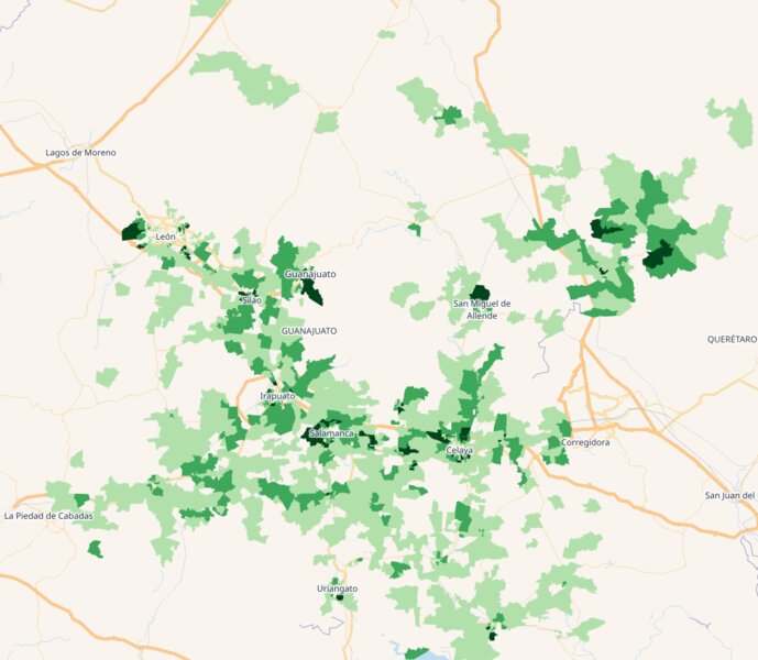
Turn Census Data Into Campaign Victory: Precise Electoral Targeting Through Geographic Intelligence
How smart campaigns use 2024 census data and geospatial analysis to identify the exact neighborhoods where elections are won and lost through precise electoral targeting and geographic intelligence.
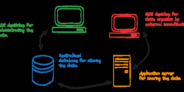
Enhancing Geospatial Data Workflows with Advanced Integration of PostgreSQL, GeoServer, and QGIS: A Case Study with the City of Tampere
A comprehensive case study demonstrating advanced integration of PostgreSQL, GeoServer, and QGIS for environmental data management in municipal workflows.