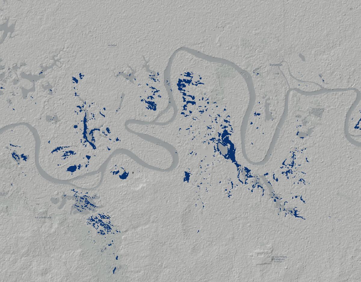
From Satellite to Survival: Quantifying the Scale of Mexico's Catastrophic Floods
Using Sentinel-1 SAR satellite data and Google Earth Engine to quantify the exact extent of catastrophic flooding in Central and Eastern Mexico, providing critical geospatial intelligence for disaster response.