Speaking Engagements
Speaking Engagements & Technical Presentations
I present at international conferences, workshops, and professional events on open source geospatial technologies, enterprise GIS solutions, and technical consulting topics. My presentations focus on practical implementations, real-world case studies, and emerging trends in the geospatial technology landscape.
Recent Conference Presentations
Below are my recent speaking engagements at major international geospatial conferences, representing both technical expertise and industry participation.
 Presentation
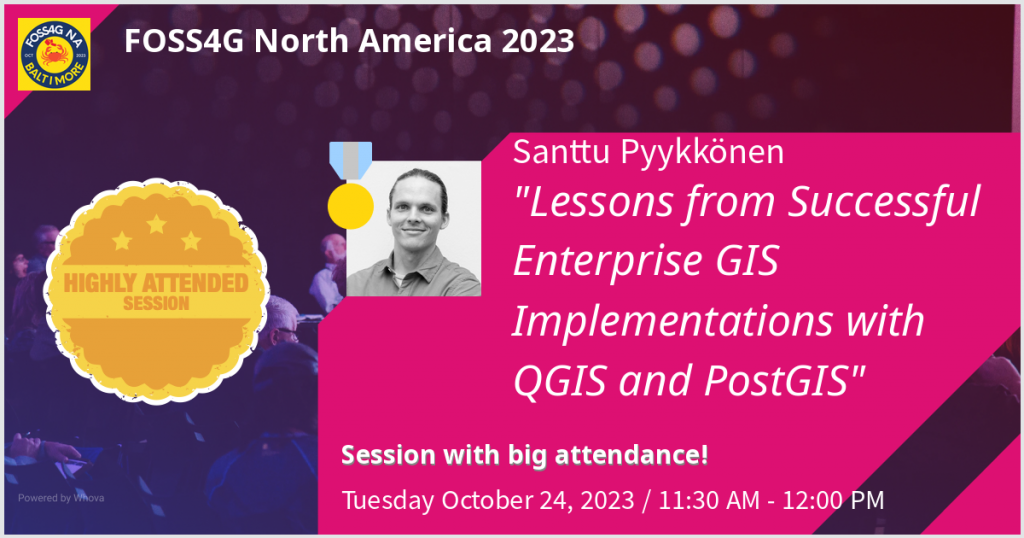
Cloud-Native Geospatial Technologies and Enterprise Solutions
Presentation on cloud-native geospatial technologies and their impact on enterprise workflows, representing Gispo Finland Ltd. at FOSS4G North America.
 Presentation
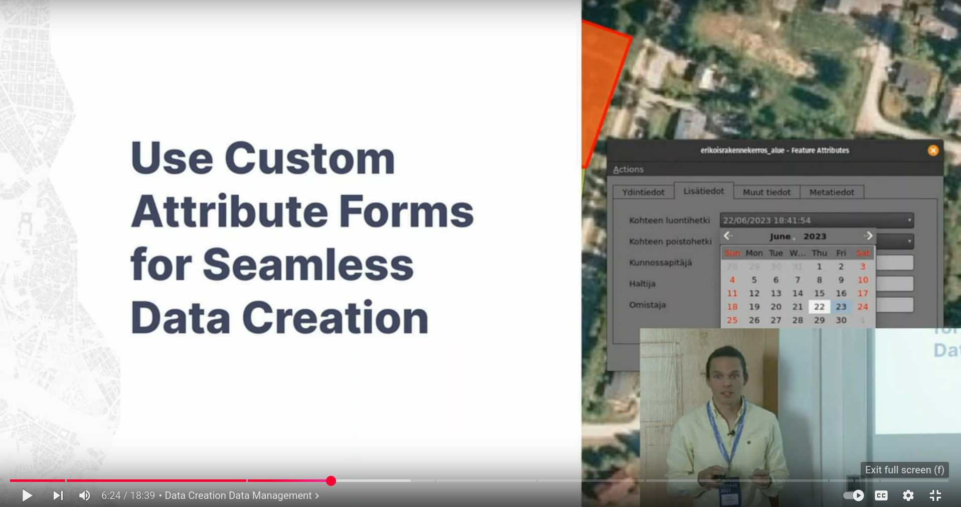
PostGIS and QGIS Enterprise Solutions for Modern Geospatial Workflows
Workshop and presentation on leveraging PostGIS and QGIS for enterprise-scale geospatial solutions, representing Gispo Finland Ltd. at the premier global open source geospatial conference.
Available Speaking Topics
I offer presentations and workshops on the following technical areas, drawing from hands-on consulting experience and real-world implementations:
Enterprise Open Source GIS
PostGIS, QGIS, and GeoServer Implementation
- Enterprise-scale PostGIS database design and optimization
- QGIS deployment strategies for multi-user environments
- GeoServer configuration for web mapping and data publishing
- Integration patterns connecting desktop GIS with web platforms
- Performance tuning for large datasets and concurrent users
Format: 45-minute presentation or 3-hour hands-on workshop
Spatial SQL and Database Technologies
Modern Approaches to Geospatial Data Management
- SQL-first approaches for geospatial data analysis
- Cloud-native spatial database strategies
- GeoPackage for portable spatial data workflows
- PostGIS advanced querying and optimization techniques
- Migrating from file-based to database-centric GIS workflows
Format: 30-45 minute presentation or 2-hour technical workshop
Municipal and Government GIS Solutions
Open Source Alternatives for Public Sector
- Case studies from municipal GIS implementations
- Cost-effective alternatives to proprietary GIS software
- Training strategies for government GIS staff
- Data integration challenges in public sector environments
- European institutional GIS capacity building
Format: 45-minute presentation with case study examples
Point Cloud Processing and 3D Geospatial Data
Modern Tools for LiDAR and 3D Analysis
- QGIS point cloud capabilities and workflows
- WhiteboxTools integration for advanced terrain analysis
- Processing large LiDAR datasets with open source tools
- 3D visualization and analysis techniques
- Digital elevation model generation and validation
Format: 30-45 minute technical presentation
Open Source Technology Policy and Adoption
Strategic Technology Decisions in the Geospatial Sector
- Open source adoption strategies for organizations
- Digital sovereignty and technology independence
- International perspectives on open source policy
- Community-driven development and sustainability
- Cost-benefit analysis of open source vs. proprietary solutions
Format: 30-minute presentation or panel discussion
GIS Automation and Workflow Optimization
Streamlining Repetitive Geospatial Tasks
- QGIS Graphical Modeler for workflow automation
- Python scripting for GIS process automation
- Batch processing techniques for large datasets
- Quality assurance and validation workflows
- Documentation and sharing of automated processes
Format: 45-minute presentation or 2-hour hands-on workshop
Speaking Experience
International Conferences
- FOSS4G Global: The premier international conference for open source geospatial software
- FOSS4G Regional: North American and European regional conferences
- Industry Events: Professional geospatial and technology conferences
Institutional Training
- European Commission: QGIS training for EU policy officials
- Municipal Organizations: GIS capacity building for local government
- Corporate Training: Enterprise GIS implementation workshops
Technical Expertise Areas
- Open source geospatial software implementation
- Enterprise GIS architecture and deployment
- Spatial database design and optimization
- Municipal and government GIS solutions
- International technology policy and digital sovereignty
Event Organizer Information
Presentation Formats Available
- Keynote Presentations: 30-45 minutes + Q&A
- Technical Sessions: 20-30 minutes focused presentations
- Hands-on Workshops: 2-4 hour practical training sessions
- Panel Discussions: Industry trends and technology policy topics
- Lightning Talks: 5-10 minute focused technical topics
Technical Requirements
- Standard conference AV setup (projector, microphone)
- Internet connection for live demonstrations
- Workshop venues with power outlets for participant laptops
- QGIS and PostgreSQL/PostGIS for hands-on sessions
Languages
- English: Native-level proficiency for international conferences
- Finnish: Native language for local and regional events
- Spanish: Professional proficiency for Latin American markets
Travel and Availability
Available for conferences and events globally. Based between Finland and Mexico, with experience presenting in Europe, North America, and internationally.
Request a Presentation
I’m available to speak at conferences, workshops, training events, and professional gatherings focused on geospatial technology, open source software, and technical consulting topics.
Ideal Events
- Open source geospatial conferences and meetups
- Municipal and government technology events
- Enterprise GIS user conferences
- Academic workshops and training programs
- Technology policy and digital sovereignty forums
For speaking inquiries and event proposals: Contact me
All presentation topics draw from real-world consulting experience, actual project implementations, and hands-on technical expertise in open source geospatial technologies.