Featured Technical Insights
Deep-dive technical articles and case studies from real-world geospatial consulting projects
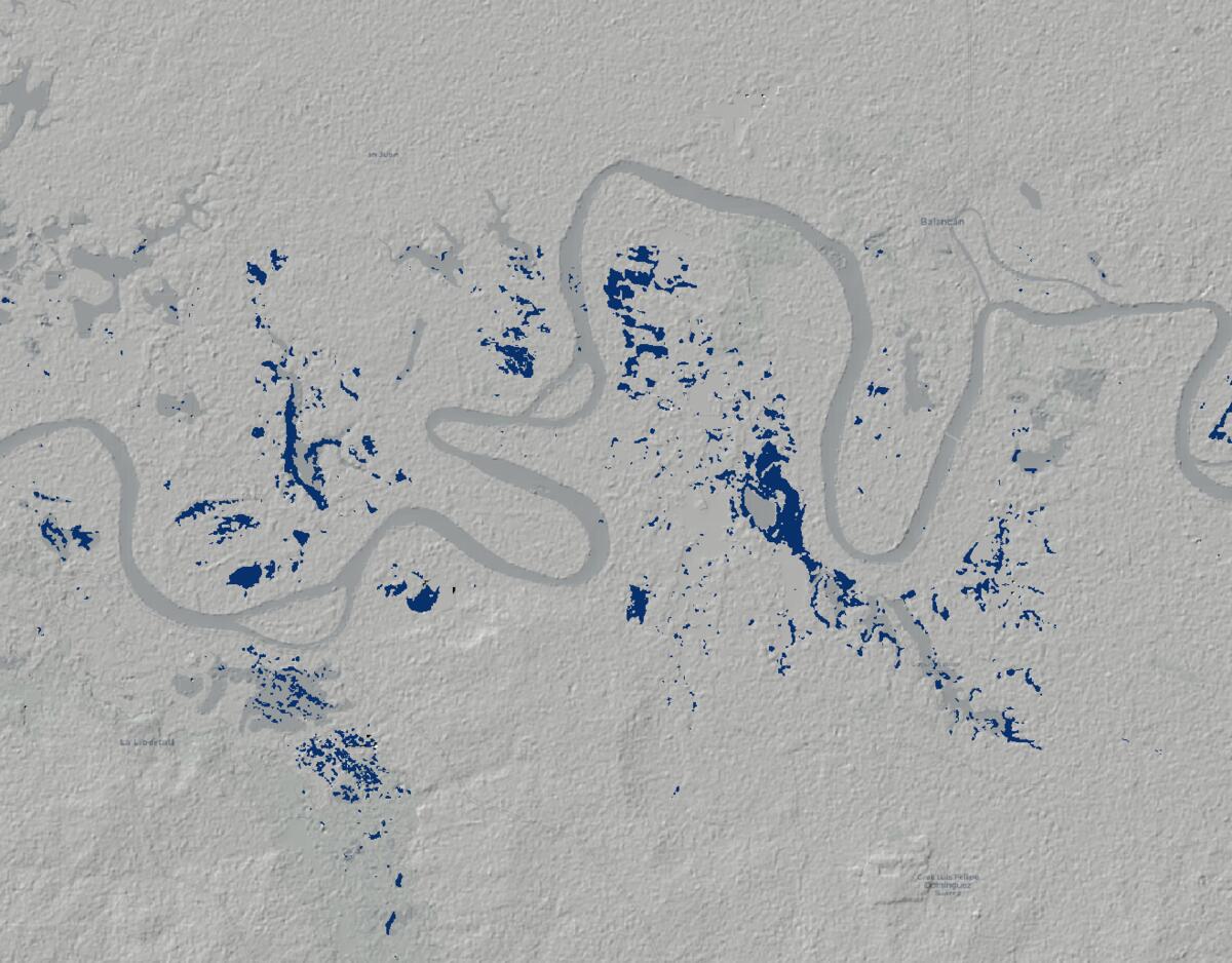
From Satellite to Survival: Quantifying the Scale of Mexico's Catastrophic Floods
Using Sentinel-1 SAR satellite data and Google Earth Engine to quantify the exact extent of catastrophic flooding in …
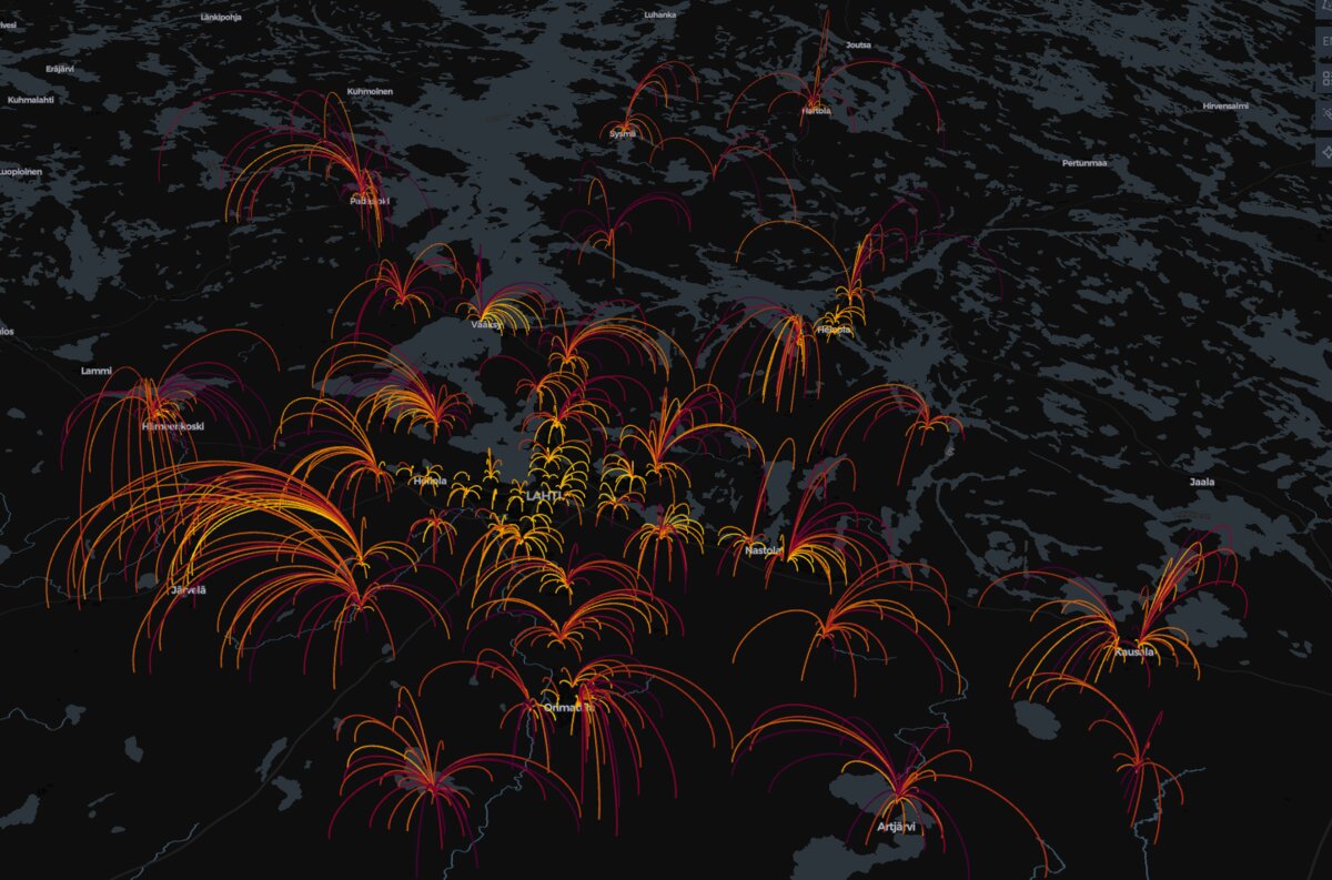
The Domino Effect of School Closures: A Geospatial Look at Service Network Decisions
The Cost of Savings: How a simulated school network analysis uses GIS data to reveal the significant human impact of …
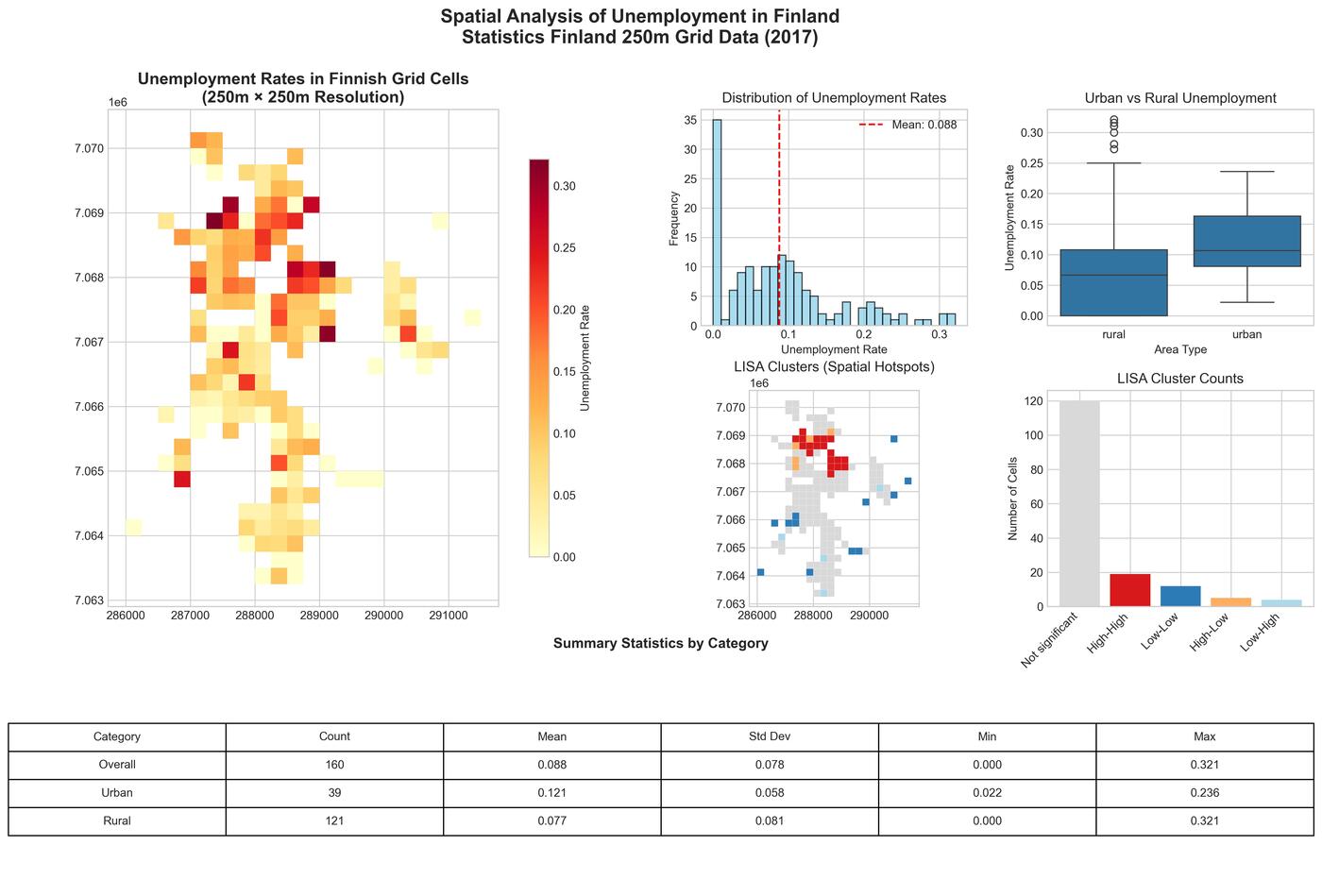
Mapping Unemployment: Spatial Patterns and Clusters in Jakobstad with Finland's Fine-Grained Statistical Data
A comprehensive spatial analysis of unemployment patterns in Jakobstad, Finland using Statistics Finland's 250-meter …
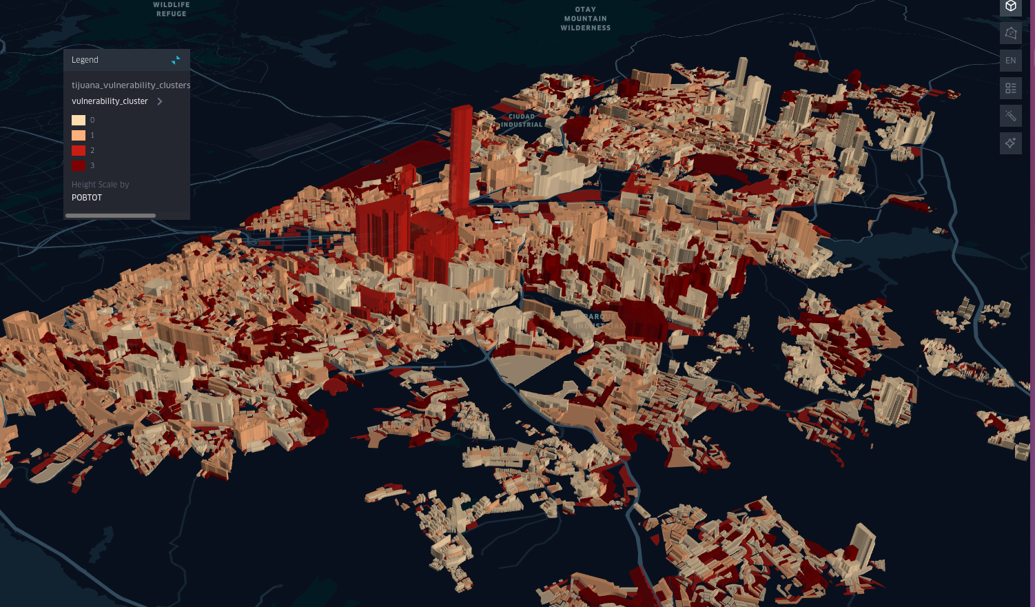
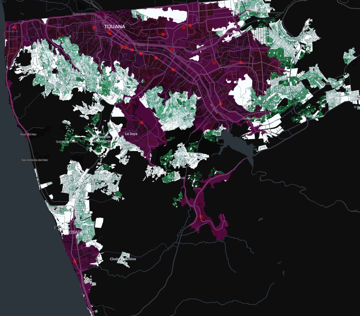
Spatial Patterns of Infant Poverty in Mexico: A Case Study of Tijuana
An in-depth analysis of infant poverty in Tijuana, Mexico, using spatial data and machine learning techniques.
Turn Census Data Into Campaign Victory: Precise Electoral Targeting Through Geographic Intelligence
How smart campaigns use 2024 census data and geospatial analysis to identify the exact neighborhoods where elections are …
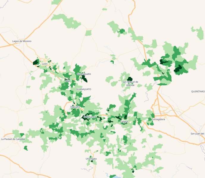
Strategic GIS Analytics for Mexican Banking: Unlocking Hidden Optimization Potential Through Census-Driven Branch Network Analysis
A strategic GIS methodology using INEGI census data and branch locations to identify significant cost optimization …
Geospatial Expertise
Strategic consulting and technical solutions that transform spatial data into actionable insights

Strategic GIS Consulting
Transform your spatial data into strategic business advantage. With extensive experience in geospatial solutions and strategic planning, I help organizations make data-driven decisions using location intelligence.

Enterprise GIS System Integration
Expert in enterprise-level GIS system integration, focusing on seamless connectivity between geospatial platforms, databases, and business systems. I specialize in creating cohesive geospatial ecosystems that align with organizational needs.