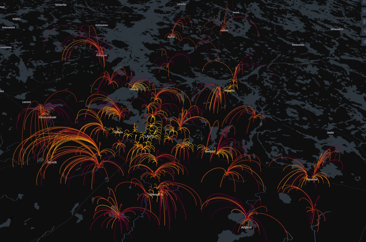
The Domino Effect of School Closures: A Geospatial Look at Service Network Decisions
The Cost of Savings: How a simulated school network analysis uses GIS data to reveal the significant human impact of minor policy changes, quantifying the surge in commute distances for children affected by school closures.
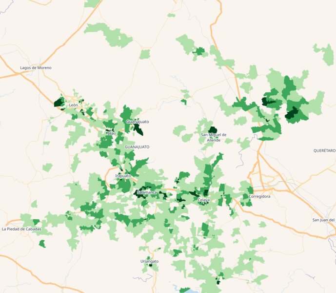
Turn Census Data Into Campaign Victory: Precise Electoral Targeting Through Geographic Intelligence
How smart campaigns use 2024 census data and geospatial analysis to identify the exact neighborhoods where elections are won and lost through precise electoral targeting and geographic intelligence.
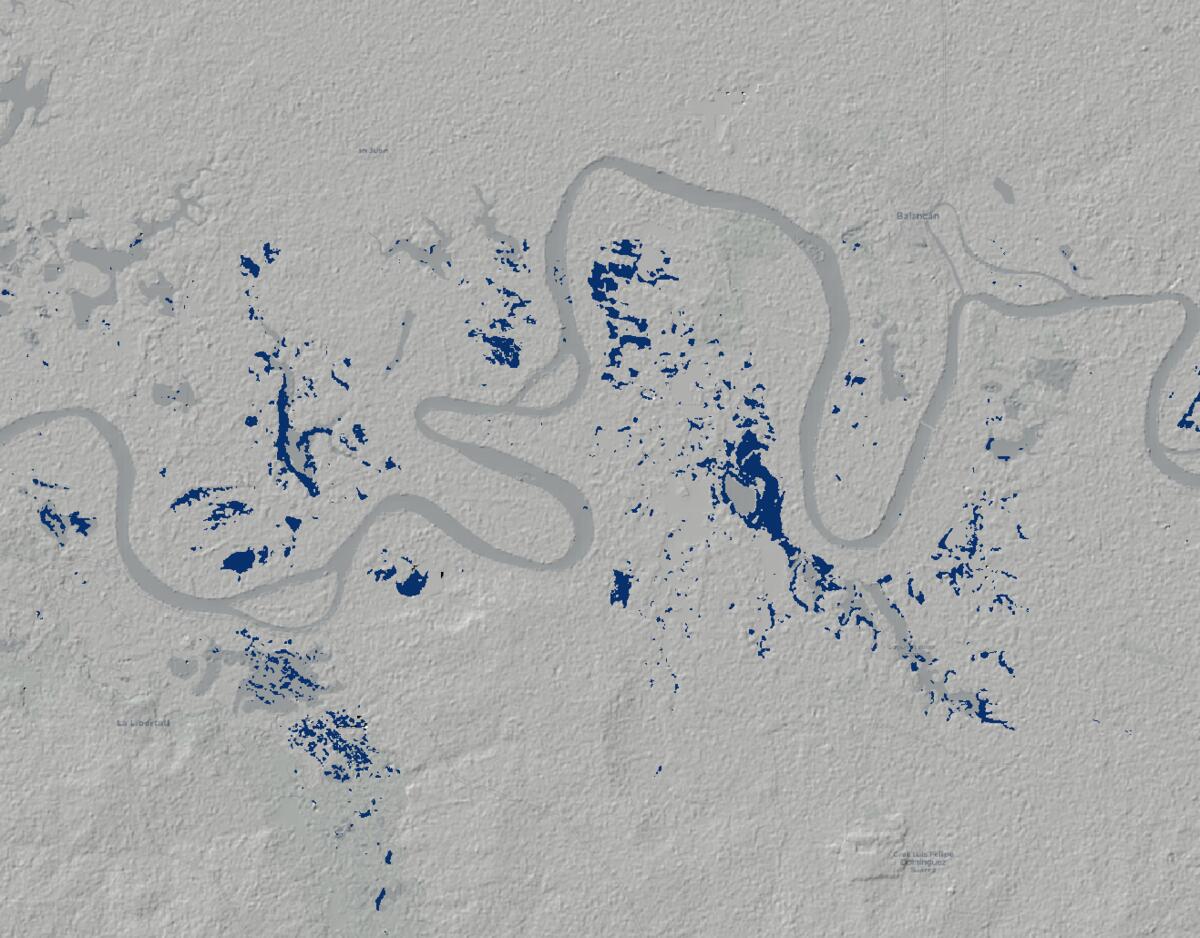
From Satellite to Survival: Quantifying the Scale of Mexico's Catastrophic Floods
Using Sentinel-1 SAR satellite data and Google Earth Engine to quantify the exact extent of catastrophic flooding in Central and Eastern Mexico, providing critical geospatial intelligence for disaster response.
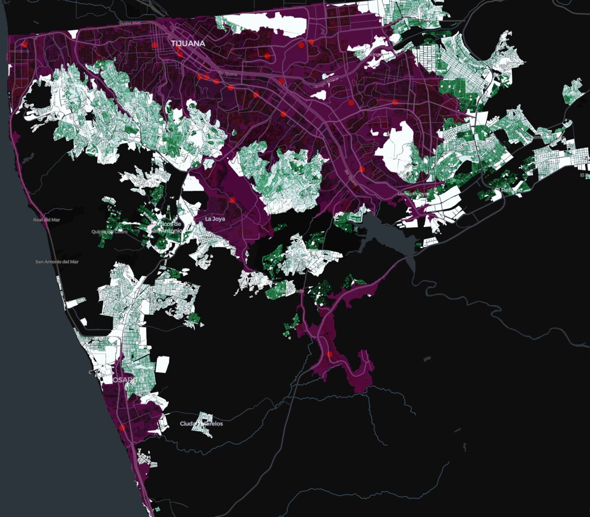
Strategic GIS Analytics for Mexican Banking: Unlocking Hidden Optimization Potential Through Census-Driven Branch Network Analysis
A strategic GIS methodology using INEGI census data and branch locations to identify significant cost optimization opportunities in Mexican banking networks through sophisticated spatial analysis.