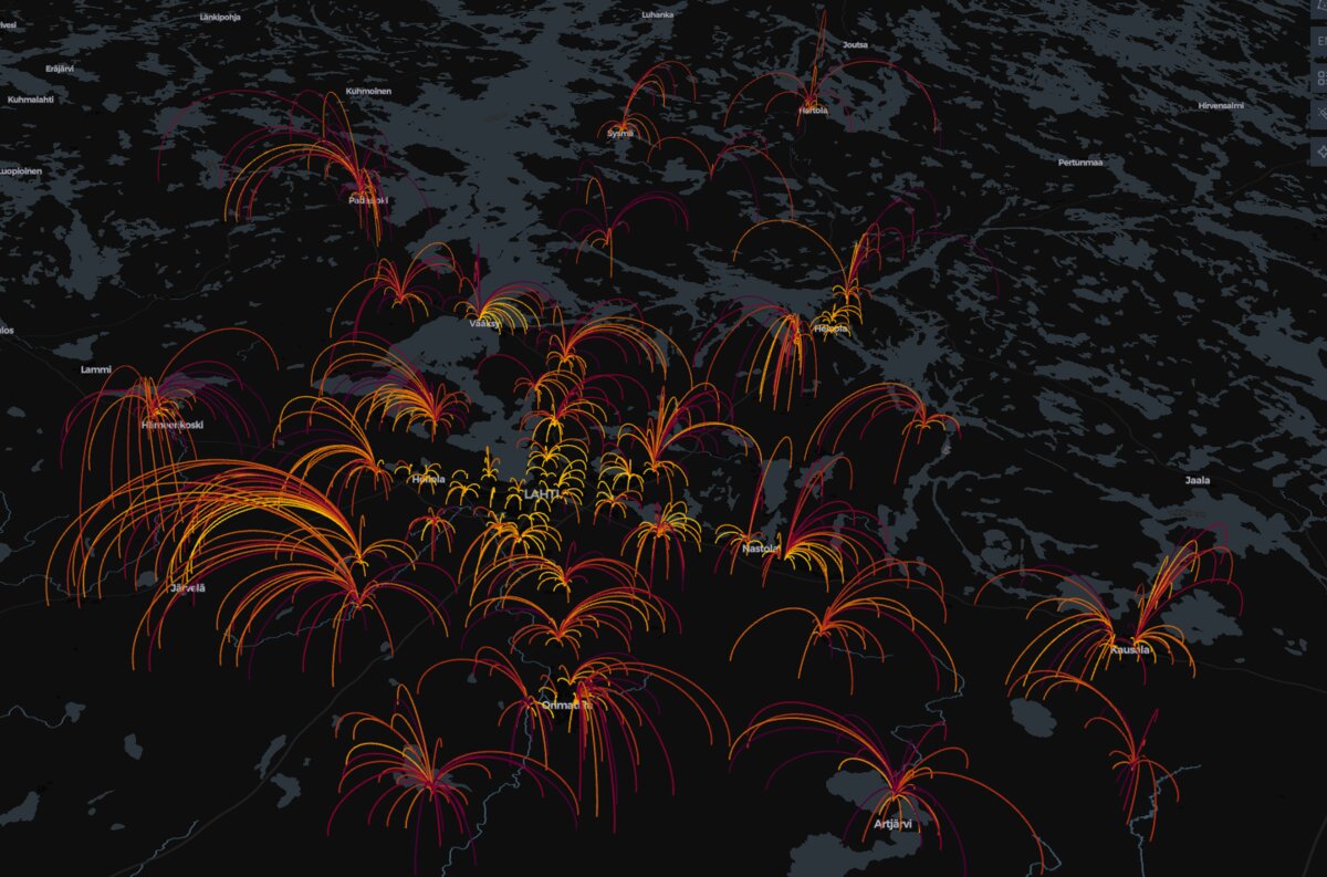
The Domino Effect of School Closures: A Geospatial Look at Service Network Decisions
The Cost of Savings: How a simulated school network analysis uses GIS data to reveal the significant human impact of minor policy changes, quantifying the surge in commute distances for children affected by school closures.
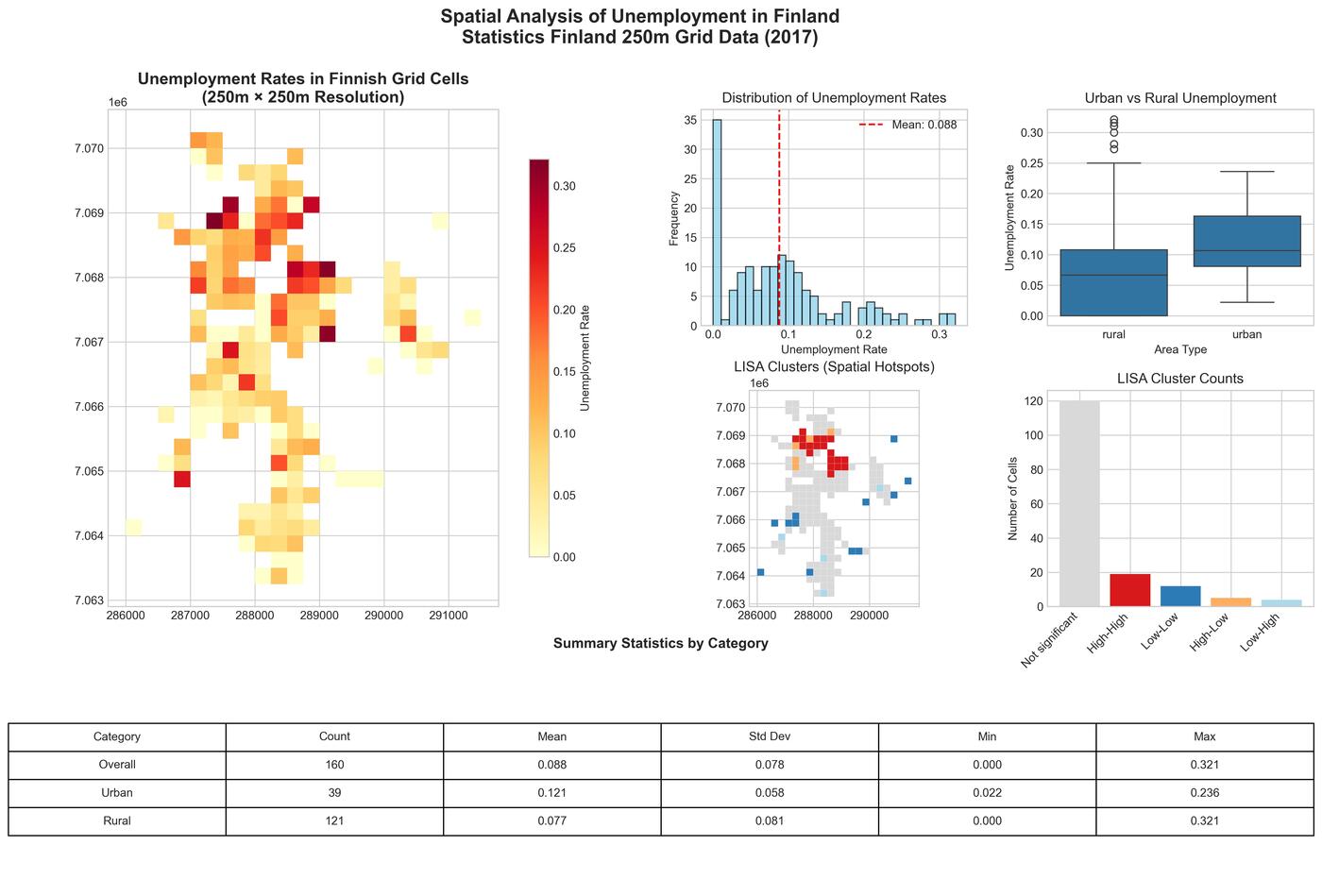
Mapping Unemployment: Spatial Patterns and Clusters in Jakobstad with Finland's Fine-Grained Statistical Data
A comprehensive spatial analysis of unemployment patterns in Jakobstad, Finland using Statistics Finland's 250-meter grid data, revealing urban-rural disparities and spatial clustering through advanced GIS techniques.
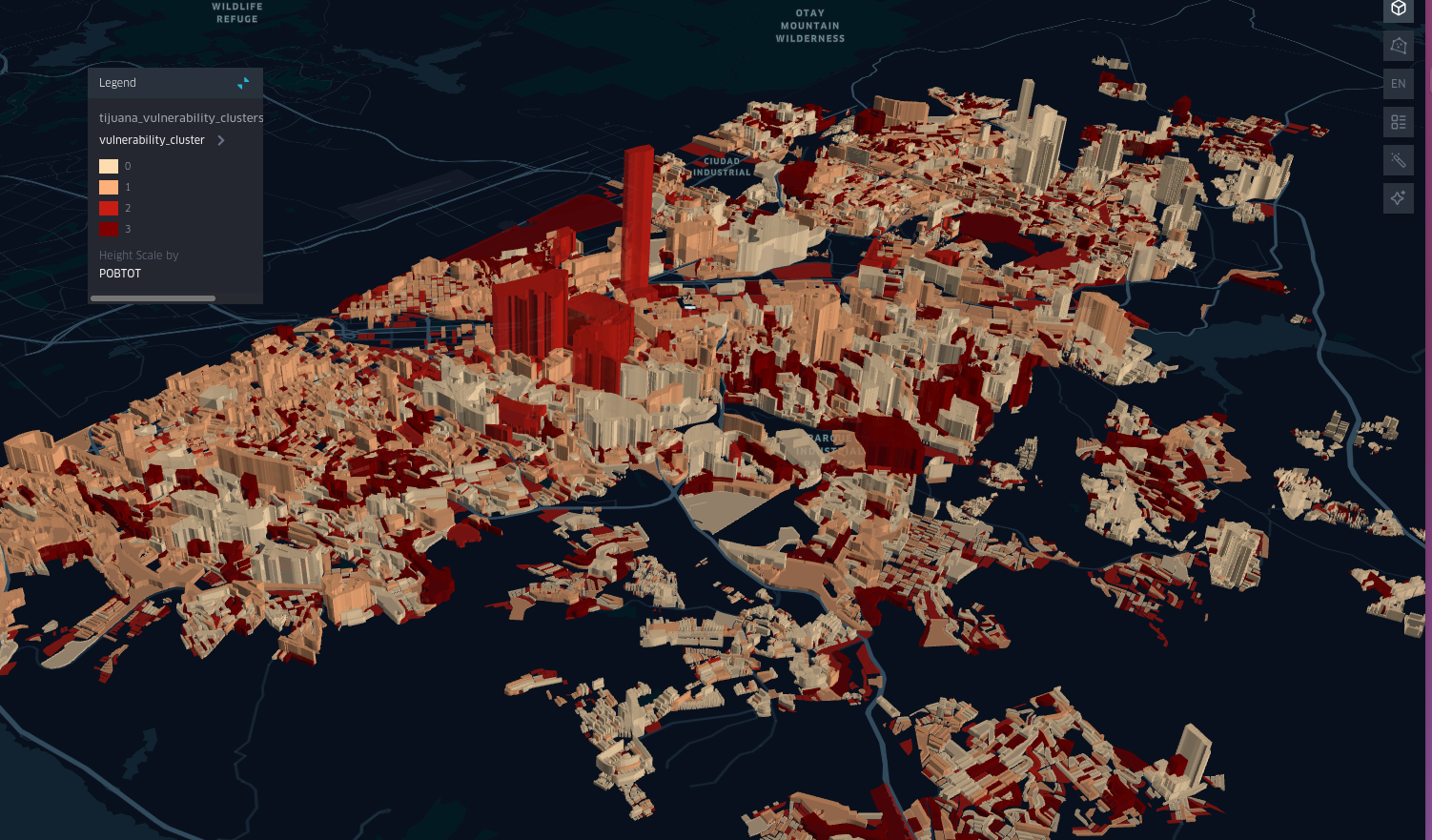
Spatial Patterns of Infant Poverty in Mexico: A Case Study of Tijuana
An in-depth analysis of infant poverty in Tijuana, Mexico, using spatial data and machine learning techniques.