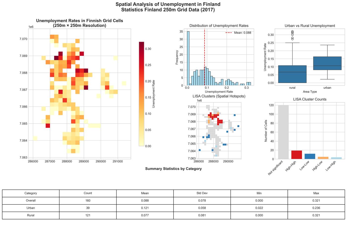
Mapping Unemployment: Spatial Patterns and Clusters in Jakobstad with Finland's Fine-Grained Statistical Data
A comprehensive spatial analysis of unemployment patterns in Jakobstad, Finland using Statistics Finland's 250-meter grid data, revealing urban-rural disparities and spatial clustering through advanced GIS techniques.
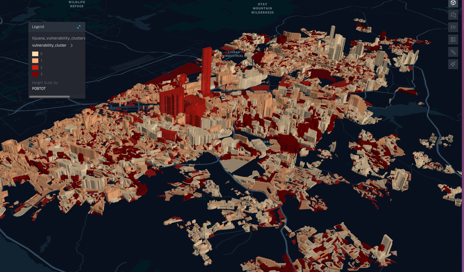
Spatial Patterns of Infant Poverty in Mexico: A Case Study of Tijuana
An in-depth analysis of infant poverty in Tijuana, Mexico, using spatial data and machine learning techniques.