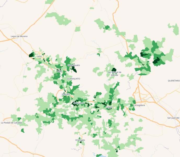
Turn Census Data Into Campaign Victory: Precise Electoral Targeting Through Geographic Intelligence
How smart campaigns use 2024 census data and geospatial analysis to identify the exact neighborhoods where elections are won and lost through precise electoral targeting and geographic intelligence.
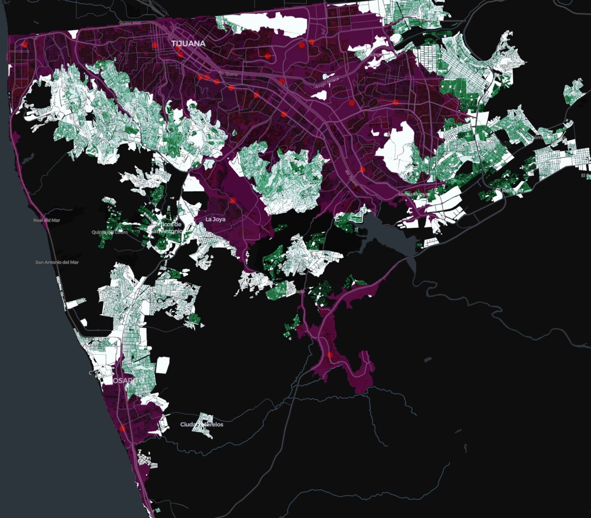
Strategic GIS Analytics for Mexican Banking: Unlocking Hidden Optimization Potential Through Census-Driven Branch Network Analysis
A strategic GIS methodology using INEGI census data and branch locations to identify significant cost optimization opportunities in Mexican banking networks through sophisticated spatial analysis.